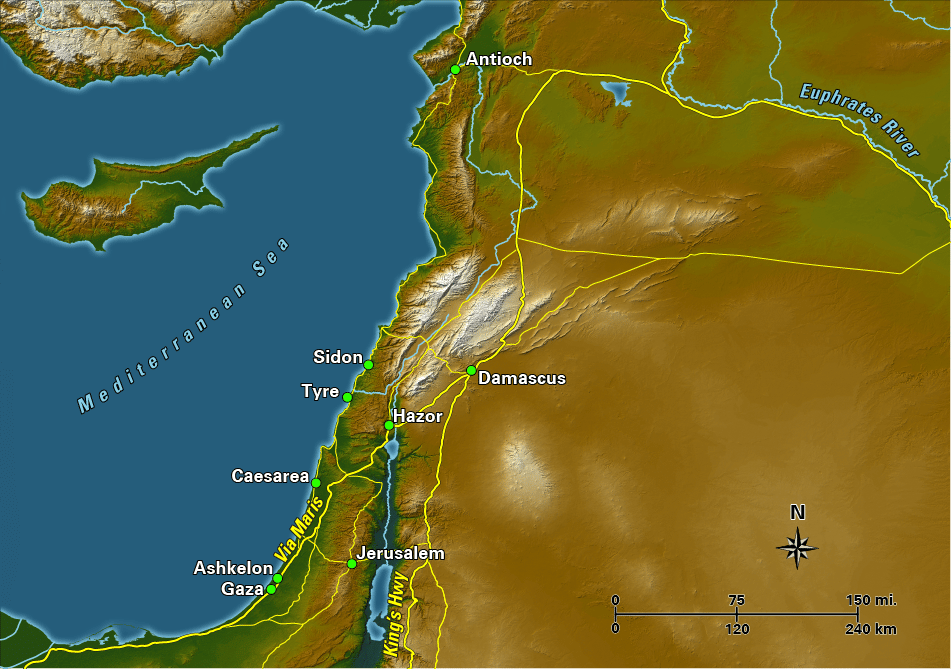
The land of Canaan has been called the “sacred bridge,” a strip of land that connects two worlds. In ancient times it was the only way to travel between Egypt and Mesopotamia, since a more direct route through the Arabian Desert was impractical if not impossible. There were two major arteries for international trade that traversed the land. The coastal highway, or Via Maris, followed along the coast of the Mediterranean and cut through the Jezreel Valley and along the shore of the Sea of Galilee before heading north into Damascus. (Some historical geographers argue that Via Maris was not the coastal highway, but rather an east-west artery in northern Israel.) The other major route, the King’s Highway, was located to the east along the high fertile plain beyond the Dead Sea and the Jordan River. The two routes converged on Damascus, where the route splits toward Antioch to the north, and towards Mesopotamia to the east.
A regional route worth noting, though of less importance for international commerce, is known as the Ridge Route, which traveled through the hills of Judea and Samaria, passing by the city of Jerusalem.
The impact these international trade routes had on the cultures and societies of ancient Canaan cannot be underestimated. The strategic importance of this land bridge for gaining and maintaining power and wealth in antiquity is reflected in the constant struggle that went on between regional and imperial powers to control the region for centuries.